New WCA Member Discounts are Available! Click for more information

Fire Map Shows Current Extent of Fire on Nora, Florence, North Cross and South Cross Lakes

Posted on: May 11, 2016  |  

Fireview Map Updated as of 4:00 PM May 11th

Fireview Map Updated as of 4:00 PM May 11th


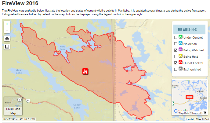
The Fireview Map shows the location and status of current wildfire activity.  Updated versions are available online at http://www.gov.mb.ca/conservation/fire/Fire-Maps/fireview/fireview.html


Leave a Reply

All News Categories

guests shared a lovely shot. Sitting at the beach looking north over the forest they got a lovely view of the northern lights. ... See MoreSee Less
View on Facebook
Photos from Tallpine Lodges's post ... See MoreSee Less
View on Facebook
Andrew Lindsay – “The community of Eleanor Lake cleaned garbage from the ditches from the park office to Otter Falls. Huge props to the volunteers and organizers.” ... See MoreSee Less
View on Facebook
Jamie King – “Can you post “our 6foot pontoon got broke off our dock at Brereton lake” this is an example of it.” ... See MoreSee Less
View on Facebook
Daniel Alexander – “Cactus Jack is back” White Porcupine. Whiteshell. ... See MoreSee Less
View on Facebook

Recent Instagram Posts